Fotos Urbanas
sábado, 30 de junho de 2012
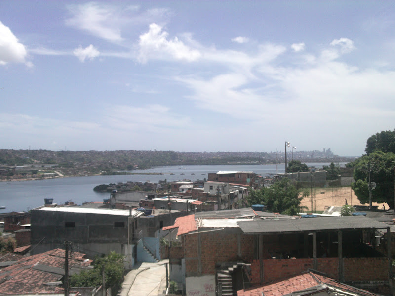
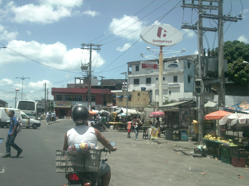
Plataforma (Salvador)Plataforma é o nome de um bairro de Salvador.[1] O Ponto de acesso principal ao Alto do Luso onde é possível seguir dois caminhos que definem o bairro. Este dois caminhos são na verdade duas ladeiras, uma que vai em direção à praça de Plataforma, rumo a via ferroviária, e a outra que segue em direção ao Bariri, ao Conjunto Senhor do Bonfim, ao Parque Residencial Baía de Todos os Santos e aos bairros de Ilha Amarela e Alto de Santa Terezinha. De Plataforma pode-se seguir para o bairro da Ribeira através de uma lancha que liga os dois bairros, como também, pode-se seguir para o bairro da Calçada através de trem urbano ou ônibus. - Platform (Salvador) Platform is the name of a district of Salvador. [1] The main access point to the High Luso where you can follow two paths that define the neighborhood. These two paths are actually two slopes, one that goes toward the square platform, toward the rail, and another that goes towards the Bariri, the Joint Senhor do Bonfim, Residential Park Bay of All Saints and neighborhoods Yellow and High Island of St. Therese. Platform can be followed to the Ribeira neighborhood through a boat that connects the two neighborhoods, but also can be followed for the neighborhood's Walk by commuter train or bus. - Platform (Salvador) Platform är namnet på en stadsdel i Salvador. [1] Den viktigaste kopplingspunkt för att den höga Luso där du kan följa två vägar som definierar området. Dessa två vägar är faktiskt två backar, en som går mot torget plattformen, mot järnväg, och en annan som går mot Bariri, den gemensamma Senhor gör Bonfim, Residential Park Bay of All Saints och stadsdelar gul och High Island i St Therese. Plattform kan följas till Ribeira grannskapet genom en båt som förbinder de två stadsdelarna, men också kan följas för området: s Walk med pendeltåg eller buss. - Platform (Salvador) Plattform ist der Name eines Stadtteils von Salvador. [1] Der wichtigste Zugang zum Hohen Luso, wo man zwei Wege, die die Nachbarschaft zu definieren folgen können. Diese beiden Wege sind eigentlich zwei Pisten, eine, die in Richtung der quadratischen Plattform geht, in Richtung der Schiene, und eine andere, die in Richtung der Bariri geht, tun das Gemeinsame Senhor Bonfim, Wohnpark Bucht aller Heiligen und Nachbarschaften Gelb und High Island of St. Therese. Plattform kann auf die Ribeira Nachbarschaft durch ein Boot, das die beiden Stadtteile verbindet verfolgt werden, sondern kann auch für die Nachbarschaft 's Walk S-Bahn oder dem Bus folgen. - プラットフォーム(サルバドール)プラットフォームは、サルバドールの地区の名前です。[1] あなたは近所を定義する二つのパスに従うことができ、高ルソへの主要なアクセスポイント。これら2つのパスは、レールに向かって、実際には2つの斜面に、正方形のプラットフォームに向かって行く一つであり、Baririに向かって行くことを別の、共同ポルトガル紳士はボンフィム、すべての聖人と近隣の住宅公園ベイを行う聖テレーズの黄色とハイ島。プラットフォームは、2地区を結ぶ船を介してリベイラ地区に続くことができるだけでなく、通勤電車やバスで近所の散歩のために続けることができます。
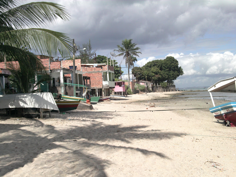
Itacaranha é um subúrbio da orla ferroviária da cidade de Salvador.[1] Tem como vizinhos os subúrbios de Plataforma, Escada, Ilha Amarela, Alto da Terezinha. O nome é de origem indígena: ita = Pedra, caranha = espécie de peixe muito importante para os índios tupinambás enquanto habitaram a localidade.Itacaranha já abrigou uma grande lagoa - a lagoa Dourada. Reza a lenda que portugueses, quando estavam desocupando o país, saindo às pressas, deixaram um baú cheio de jóias preciosas no fundo dessa lagoa, preso somente por uma corrente grossa. Quando os portugueses a puxaram para resgatar o tesouro, a corrente se havia quebrado por ter ficado bastante tempo na água, e o tesouro jamais foi visto - por isso o nome "dourada". Há relatos de moradores bem antigos que dizem ainda existir um elo da corrente que prendia o tesouro. A lagoa foi aterrada aos poucos para construções de moradias, e hoje existe um campo de futebol bem ao lado de sua nascente. O campo, por sua vez, tem o nome de "campo da lagoa dourada". Outra grande perda foram as dunas, que, com a duplicação da linha férrea, deixaram de existir. Com o crescimento populacional as chácaras da região também foram dando lugar a loteamentos urbanos. Apesar de tudo, ainda é possível desfrutar da praia e do mar calmo. Itacaranha é a terceira praia dos subúrbios ferroviários de Salvador.Suas águas são claras e tranquilas, propícias para o banho. - Itacaranha is a suburb of the railroad from the city of Salvador. [1] Its neighboring suburbs Platform, Ladder, Yellow Island, Top of Therese. The name is of indigenous origin: ita = Stone = snapper fish species important to the Indians inhabited the tupinambás while localidade.Itacaranha once housed a large pond - the Golden Pond. Legend has it that the Portuguese, when they were withdrawing from the country, leaving hastily left a trunk full of precious gems at the bottom of the pond, attached only by a thick chain. When the Portuguese pulled her to retrieve the treasure, the chain was broken for a long time have been in the water, and the treasure was never seen - hence the name "golden." There are reports of very old residents who say there is still a link in the chain that held the treasure. The lagoon has been gradually grounded for construction of houses, and there is now a soccer field right next to its source. The field, in turn, has the name "field of golden pond". Another big loss was the dunes, which, with the duplication of the railway, no longer exist. With population growth the farms of the region were also giving way to urban settlements. After all, you can still enjoy the beach and the sea calm. Itacaranha is the third beach suburbs rail Salvador.Suas waters are clear and calm, suitable for swimming.
Postagens mais recentes
Postagens mais antigas
Página inicial
Assinar:
Postagens (Atom)